Sometimes it seems we seldom talk about history anymore around the Mattole Valley Historical Society. We are busy talking up our exciting plans for developing the Square in Petrolia and building our beautiful museum and visitors’ park there.
However, meantime, as ever, Bob Stansberry has been quietly working on a unique project. It’s a map of old homesteads, cabins, and other places of significance in his neck of the woods, which is between Honeydew and Ettersburg. He’s working from the late-1960s USGS topo maps, focusing on the townships at the Township 3 South latitude. That is, the 6-mile-by-6-mile “townships” of 36 sections (each one square mile) lying roughly in a west-to-east belt inland of King’s Peak and on toward Gilham Butte, Elk Ridge, and Salmon Creek, which is part of the South Fork Eel watershed.

This excerpt from the 1911 Denny’s map shows the western part of the area addressed by Bob’s project. He goes over into Salmon Creek to the right.
The idea is to number each of the named spots on the topo maps, and on a document have notes for that number: dates of when the cabin or development was built, names of owners and/or occupants, and mention of any related stories, etc. Some of the structures are still in evidence; others have disappeared, but are either shown as small blocks on the topo maps or were already known to Bob.
In final form, the project Bob envisions has the maps copied and printed in roughly 2-foot by 2-foot squares, and the document a simple folder of several pages; but of course we can digitize this project and make it all viewable on the computer screen. If we had some help from someone who knew their way around web-page design, and we wanted to get so 21st-century, we could even make it so that if you clicked on a number on the map, you would go immediately to the matching description, and vice versa.
Bob has already identified 120 places for which he has notes, and figures he’s about 80 percent through looking for them. Basically, he’s interested if there’s any history to a place from before 1980, and says that many of the old structures dated from the 1860s. At least 100 of his identified sites are in his own township block, 3 South, Range 1 East, though he says he is not himself familiar with all of them. His knowledge of the places comes from his own personal history, roaming the hills on ranching or surveying duties, or merely exploring the woods and rangeland, and from anecdotes he heard long ago. His interest in spots he may not have known of otherwise derives from places denoted on the maps by either name or the aforementioned little blocks: tiny black squares for houses, little empty outlines for outbuildings. And then, his research has led him to seek out knowledgeable old-timers in the past couple of decades, with the intention of collecting and compiling what he has learned in this most local of local-history endeavors. Some of his best informants have been Gene Landergen, Les Harrow, Lee French, Greg Mullins, his own mother—Clarice Smith Stansberry—his cousin Bill Lee, and many others.
Bob is referring to some printed resources, but essentially he is creating a primary-source archive. The 1921 Belcher’s maps, which show ownership of the larger land parcels and ranchers, have been helpful; likewise the Metsker’s maps, which are from the 1950s and ‘60s. He has the book on the history of Southern Humboldt schools. I have promised to look up a few of the spots in Turners’ Place Names of Humboldt County.
While the pilot project allows only an even-handed single line of information for each place—”just the basics or highlights”—Bob has a lot more in the way of stories that will probably go into a later update. Using the same place numbers assigned for the initial list, it would be easy to attach new paragraphs of information, or old photos, to flesh out the history. In chatting with him about what he’s put together so far, I find that the Pringle for whom Pringle Ridge was named was a silver miner. There was a silver mine in the area, on Grindstone Creek, and Bob’s cousin Bill Lee is probably the only living person to know the location of the mine shaft, since covered over by slides in this steep, unstable terrain. Speaking of mines, June Lindley, who later married Leo Etter, was first married to a miner in the Queen’s Peak area. The mines there were mainly seeking manganese, which was important to our military efforts in WWII. (Manganese is a corrosion-resistant alloy used in stainless steel and aluminum.)
There was an old still from Prohibition days on Bear Creek (the river feeding into the Mattole at Ettersburg, which runs roughly parallel to the coast behind the King Range, and closely below the King Peak Road for much of its length). A man named Cy (or Si) Cole ran the still. One night, probably in the late 1920s, the still blew up. The explosion was heard for quite some distance.
If anyone reading this has something to add to the treasure trove of history on this area from King’s Peak over to Salmon Creek, and between Ettersburg and Honeydew, let us know—you can comment below, or get in touch with me.
Also, it would be very helpful if someone with the ability to take crisp photographs, or scan, large documents such as sections of the topo maps, might like to contribute a little bit of their time to make a satisfactory final version of this project—in several hard copies.
This map of old homesteads and other significant places is only one of several historical documents Bob has compiled, most based on his own family stories. But this one is special in that it’s really the result of one man’s life spent in a grand, borderless place—the culmination of a lifetime spent ranching and exploring and learning about his own back yard. There are many things to be revealed that only Bob knew about… until now.
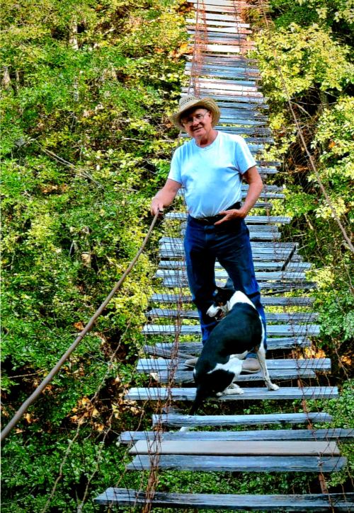
Bob Stansberry built this footbridge across the Mattole on his property around 1968-69. The half-century-old bridge is 32” wide and 330’ long.
